Mobile application · AR wayfinding
駅ナカまっぷ
The right exit, in the direction you are looking.
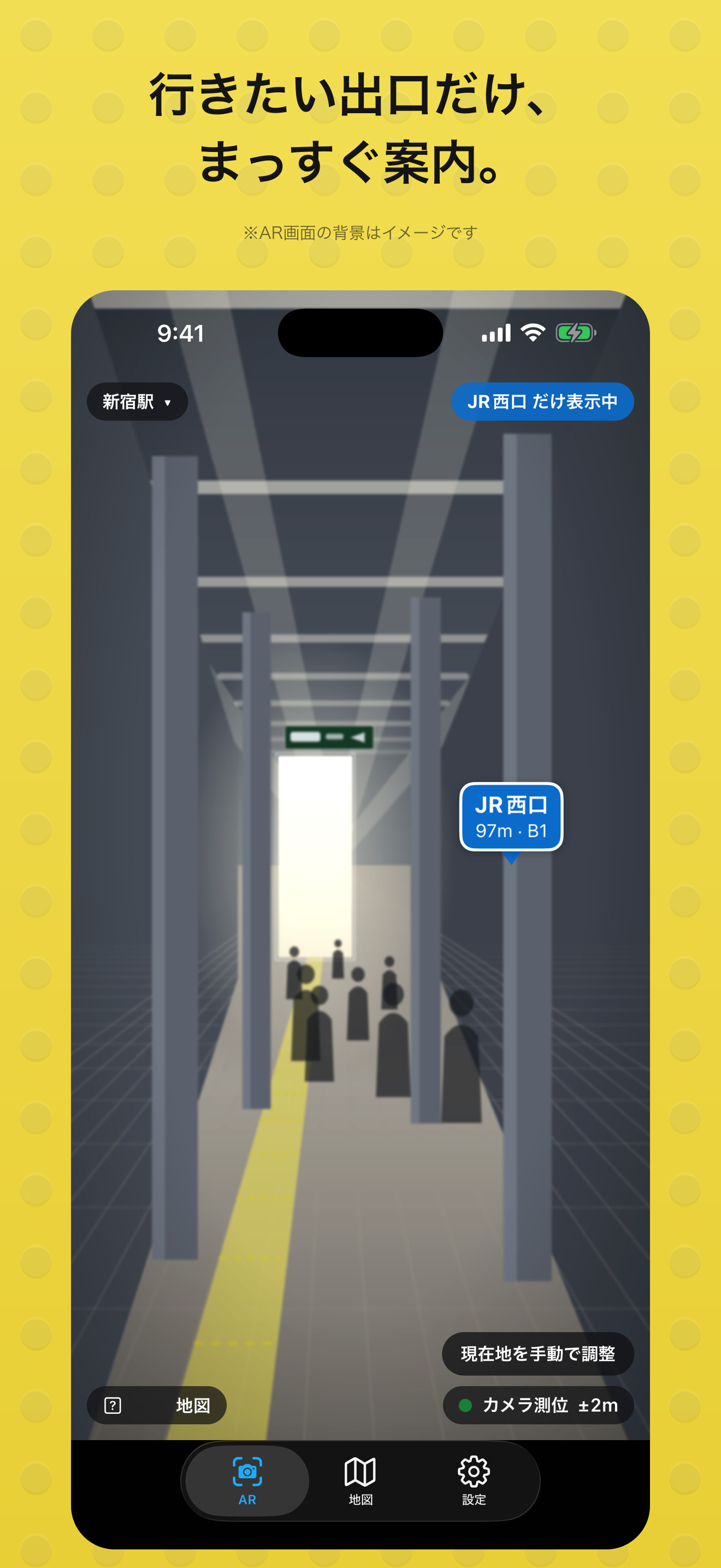
An augmented reality wayfinding app that overlays station exit names, directions and distances on the camera view, with a map for checking the surrounding layout.
カメラを向けると、駅の出口の名前、方向、距離がその場の景色に重なるアプリ。地図と目の前の風景を頭の中で照合する負担を減らし、進みたい方向を見つけやすくする。
- Title
- 駅ナカまっぷ Ekinaka Map
- Format
- Mobile application
- Interaction
- AR exit directions Map · Manual position adjustment
- Development
- React Native / Expo ARKit · ARCore
Which way is that exit?
In a large station, knowing an exit's name does not always tell you which way to turn. Reading a map also requires matching its orientation with your body and the surrounding space.
Ekinaka Map places exit labels in the direction of the exits themselves. Names and distances become cues to look toward, while the map offers another way to understand the layout.
大きな駅では、出口の名前がわかっていても、どちらへ向かえばよいか迷うことがあります。地図を読むときも、地図の向き、自分の向き、周囲の空間を頭の中で合わせる必要があります。
駅ナカまっぷは、出口がある方向に名前と距離を重ねます。進む先を探す手がかりを目の前の空間に置き、地図による全体の確認と行き来できるようにします。
Working with uncertain position
Position and orientation can drift, especially underground. The app lets users adjust their location using a known exit or ticket gate. When accuracy drops, broader direction indicators and approximate distances communicate that uncertainty.
地下などでは、現在地や向きの推定がずれることがあります。わかっている出口や改札を選んで位置を合わせ直せるようにし、精度が下がったときは方向の幅や概算の距離によって、不確かさも表示に反映します。
AR and map, together
The camera view helps with direction; the map helps with the arrangement of exits and floors. The design connects these two ways of reading space instead of asking one display to answer every wayfinding question.
カメラの画面は、向かう方向を捉えるために。地図は、出口の配置や階層を確かめるために。異なる見方を行き来できるようにすることで、駅での移動を支えます。